


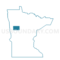
Eagle View Twp. Voting District, Becker County, Minnesota
About
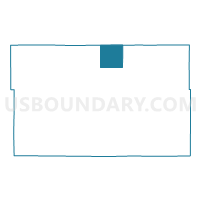
Outline

Summary
| Unique Area Identifier | 601101 |
| Name | Eagle View Twp. Voting District |
| County | Becker County |
| State | Minnesota |
| Area (square miles) | 36.25 |
| Land Area (square miles) | 31.28 |
| Water Area (square miles) | 4.97 |
| % of Land Area | 86.30 |
| % of Water Area | 13.70 |
| Latitude of the Internal Point | 47.11538690 |
| Longtitude of the Internal Point | -95.63668550 |
Maps

Graphs
Select a template below for downloading or customizing gragh for Eagle View Twp. Voting District, Becker County, Minnesota


Neighbors
Neighoring Voting District (by Name) Neighboring Voting District on the Map
- La Prairie Twp. Voting District, Clearwater County, MN
- Little Elbow Twp. Voting District, Mahnomen County, MN
- Maple Grove Twp. Voting District, Becker County, MN
- Oakland Twp. Voting District, Mahnomen County, MN
- Round Lake Twp. Voting District, Becker County, MN
- Sugar Bush Twp. Voting District, Becker County, MN
Top 10 Neighboring County Subdivision (by Population) Neighboring County Subdivision on the Map
- Sugar Bush township, Becker County, MN (504)
- Maple Grove township, Becker County, MN (455)
- La Prairie township, Clearwater County, MN (356)
- Oakland township, Mahnomen County, MN (295)
- Little Elbow township, Mahnomen County, MN (259)
- Round Lake township, Becker County, MN (183)
- Eagle View township, Becker County, MN (131)
Top 10 Neighboring Place (by Population) Neighboring Place on the Map
Top 10 Neighboring Unified School District (by Population) Neighboring Unified School District on the Map
- Detroit Lakes Public School District, MN (16,612)
- Bagley Public School District, MN (5,943)
- Waubun Public School District, MN (3,202)
Top 10 Neighboring State Legislative District Lower Chamber (by Population) Neighboring State Legislative District Lower Chamber on the Map
Top 10 Neighboring State Legislative District Upper Chamber (by Population) Neighboring State Legislative District Upper Chamber on the Map
Top 10 Neighboring 111th Congressional District (by Population) Neighboring 111th Congressional District on the Map
Top 10 Neighboring Census Tract (by Population) Neighboring Census Tract on the Map
- Census Tract 9400, Becker County, MN (3,833)
- Census Tract 2, Clearwater County, MN (2,824)
- Census Tract 9403, Mahnomen County, MN (2,467)